
Geolocation in marketing is a method of reaching a user based on the place where they are now, are there cyclically or have just appeared. In practice, it is not about the point on the map itself, but about using it at the right moment and for a clearly defined business objective. This means advertising can direct people to the nearest location, strengthen a local offer or trigger a message only when it really has a chance to work. The most effective local campaigns combine place, time, user intent and a simple action that can be measured. This approach works in search, maps and social media, as well as in apps, SMS or push notifications. The key, however, is often not the targeting itself, but the quality of the data, sensible campaign activation logic and reliable measurement of the effect.
What is geolocation in marketing and how does it work in practice
Geolocation in marketing involves activating ads or messages based on the user’s location, their presence in a defined zone or repeated visits to a given place. This can mean an advert for people within a few kilometres of a store, a message for event attendees or an offer directed at people who frequently appear in shopping centres. The most important thing is that the place has business relevance here, not just technical significance.
In practice, several mechanisms are used. Most often these are geofencing around a sales point, targeting by city or district, campaigns for people visiting specific types of places and messages triggered upon entering a location. Effectiveness increases when location is combined with an operational condition, for example product availability, opening hours or the possibility of order collection.
The process itself is fairly straightforward, provided its elements are well organised. First, you define the objective, for example store visits, phone calls, coupon redemptions or an order with in-store pickup. Next, you choose the location signal, the audience segment, the delivery moment and the message that makes sense precisely in that place and time.
Matching the channel to user intent is very important. Search and map ads work best when someone is already looking for a place or service nearby. Social media are more often useful for building local reach and reminding people about the offer, while an app, SMS or push makes sense when the brand has the user’s consent and can react almost in real time.
A practical example is a restaurant that serves ads only before lunch and only near office buildings. Another example is a retail chain promoting same-day collection only in those locations that have current stock and a working order service. The most common mistake is that the campaign knows the user’s location, but does not take into account whether the location is open, whether the offer is still current and whether the customer can take the next step immediately.
Current trends and challenges in using geolocation
The use of geolocation is increasingly based on data quality, user consent and combining marketing activities with the company’s operational data. Simply setting a radius on a map is no longer enough, because the outcome of a campaign is also determined by the data source, the accuracy of the pinpointing and whether the advert directs people to an actually available offer. For this reason, the role of a brand’s own data is growing, especially data from apps, loyalty programmes, CRM and sales systems.
One of the key challenges remains precision. GPS data can be very accurate, but it is not always available, and using it requires the appropriate permissions, while location by IP address provides a much broader approximation. In dense urban areas, shopping centres and street traffic, a radius that is too small often looks good on screen but performs unreliably in the campaign.
The second barrier is privacy and compliance with data requirements. The more precise and direct the communication becomes, the more important marketing consents, the technical source of the data and the correct implementation of tools become. This affects not only whether a push or SMS can be sent, but also how reliably the campaign result can be measured.
Increasingly, it is not the advertising platform itself that decides effectiveness, but the quality of local operational data. When the location address is wrong, the pin on the map is placed incorrectly, opening hours are out of date or the phone does not work, the campaign loses its point even with accurate targeting. In local marketing, a correct Google Business Profile, up-to-date offer status and a consistent post-click journey often have a greater impact on the result than the creative itself.
Measuring offline results remains a challenge too. Usually it cannot be reduced to a single metric, so several signals are combined, such as clicks for directions, phone calls, coupon use, code scans or sales growth at a specific location. In practice, it is worth looking not only at cost per click, but also at differences between locations, times of day and delivery areas, because that is where you can most often see what really works.
Stages of planning and delivering geolocation campaigns
The stages of planning and delivering geolocation campaigns are: choosing the objective, selecting the location signal, defining the segment, setting the delivery conditions, preparing the message, choosing the channel, measurement and optimisation. It is worth sticking to this order, because mistakes made at the outset usually spoil the results regardless of budget. First, you need to establish one specific action you expect from the user, for example a visit to the location, a phone call, collection of an order or coupon use. If a campaign is meant to achieve several different goals at once, it quickly loses clarity and becomes harder to improve later.
The second step is choosing the data source and the level of location accuracy. In practice, you can rely on geotargeting settings in advertising platforms, app data, IP address or your own customer data linked to sales points. It is worth remembering that a small radius on the map does not always translate into precision, because in a city centre, shopping centre or in street traffic, accuracy can fluctuate.
Next, you determine who should see the advert and when. It is best to combine location with context, such as time of day, type of place, visit frequency, customer status, event day or the point’s opening hours. An effective local campaign does not respond only to the place, but to the place at the right moment, which is why a restaurant should behave differently before lunch than in the evening, and a shop differently on weekdays than at the weekend.
The next step is to prepare the message and choose the delivery channel. The creative should point to the nearest location, give a real local benefit, distance or travel time, and one simple call to action. Search and maps work well for immediate intent, social media for building local reach, and an app, push or SMS when the brand has consent and wants to respond in real time.
At the end, you define the measurement method and the optimisation plan. In local campaigns, a click alone is not enough, so you also analyse clicks for directions, calls, redeemed offers, visits to the location and sales data from the location. Offline measurement is almost always approximate, so it is worth combining several signals rather than relying on a single metric. Optimisation is carried out separately for locations, delivery times, radii and messages, because these are most often behind the differences in results.
Strategies for improving the effectiveness of local campaigns
Strategies for improving the effectiveness of local campaigns come down to matching the area, time, message and measurement to the actual behaviour of the user in a given location. The best results are delivered by an operational approach, not by simply setting targeting on a map. The same brand may need different rules in office buildings, different ones in shopping centres, and different ones on transit routes.
One of the key practices is segmenting campaigns by the context of place. People passing a location on the way to work react differently from local residents, event attendees or tourists. It is not worth using one message and one schedule for all locations, because then the advert is technically correct, but it performs poorly commercially.
Combining geolocation with operational data also helps a great deal. This includes opening hours, stock levels, local pricing, click and collect availability, the event calendar or even the weather, if it genuinely affects demand. If a location does not have the stock or does not handle same-day orders, a campaign directing users there will generate cost without a meaningful return.
Effectiveness also increases when, instead of a simple radius, you take into account the actual walking or driving time. In a city centre, 2 kilometres can mean a longer route than 5 kilometres on the outskirts, so zones should be designed around actual user flows, not just the geometry of the map. The radius plays a supporting role, but user decisions are more often driven by convenience of access than by distance alone.
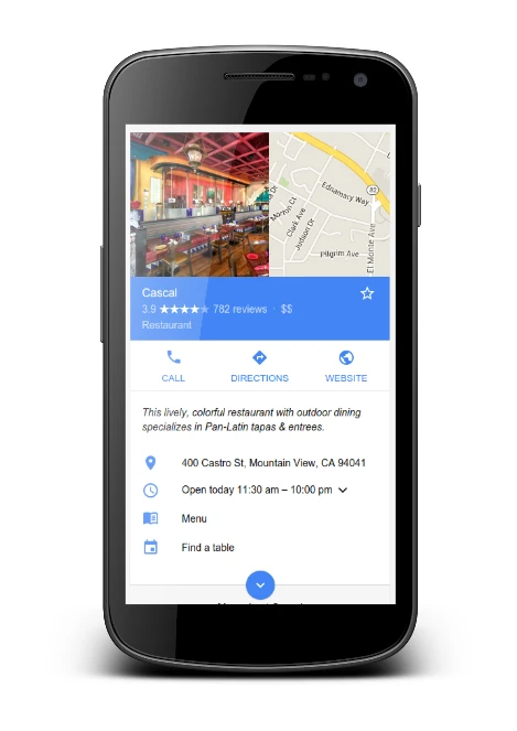
Equally important is consistency of the post-click journey. The user should land straight on a local landing page, see the correct address, a working pin on the map, a phone number and clear information about what they can do on site. If the advert promises a quick visit or collection, but after the click there is no simple route to navigation, booking or contact, the local intent quickly disappears.
Technical hygiene and frequency control also have a clear impact on results. It is worth verifying marketing consents, the source of location data, the accuracy of profiles, the consistency of opening hours and the definition of offline conversions before the campaign starts. Showing the advert too often every time someone enters the zone usually reduces effectiveness instead of increasing it, which is why it is better to test different contact thresholds, exclude employees and limit accidental passes through the delivery area.
Most common mistakes and limitations in geolocation campaigns
The most common mistakes and limitations in geolocation campaigns include too small a delivery radius, poorly matched location context, weak operational data and overestimating location accuracy. In practice, a campaign does not lose because “geolocation does not work”, but because the place signal has not been linked to the user’s real intent. Someone passing a shop by car behaves differently, a person working 300 metres away behaves differently again, and so does a customer already in a shopping centre. The mere fact of being near a location does not mean readiness to buy.
A very common mistake is setting too narrow a zone around the location. On a map it looks precise, but in dense urban development, with street traffic or inside shopping centres, location can be unstable. The result is simple: the campaign loses reach faster than it gains relevance. It is better to test zones by actual walking or driving time rather than by arbitrary metres.
The second problem is failing to match the delivery time and message to the user’s situation. An advert for lunch after lunch hours, a message about click and collect after the location has closed, or an offer for passers-by without a quick action option usually burns through budget. A local campaign must answer the question: what can the user do here and now.
Operational errors that are not formally part of the advertising often worsen results too. Outdated opening hours, an incorrect phone number, a pin placed in the wrong position on the map, missing information about product availability or an inconsistent profile can reduce the effectiveness of even a well-planned campaign. If a user lands on out-of-date data after clicking, local targeting stops being justified.
Limitations also stem from location data sources and privacy requirements. Targeting based on the advertising platform’s settings works differently from targeting that uses app data, and a different approach again applies to one based on your own customer data. The ability to use push, SMS or visit data depends on consent, the quality of user identification and technical integration with a CRM or app. This affects not only reach, but also what can later be measured reliably.
Another mistake is the lack of exclusions and quality filters. Without them, a campaign can “catch” staff from the venue, people merely driving through the area, or users outside the real service area. In practice, it is worth distinguishing a random visit from actual presence on site, if the tool allows you to take dwell time or visit frequency into account.
A problem can also be combining several objectives in one campaign. When one creative is meant to bring people into the store, generate calls and promote the app at the same time, it is harder to assess what is actually driving the result. In local campaigns, the simplest approach is to optimise one main objective for one location or for a group of similar locations.
It is also worth remembering that measuring offline impact is, by definition, an approximation. Clicking for directions, making a phone call or activating a voucher are useful signals, but they do not always translate into sales. That is why the limitation may lie not only in the ad itself, but also in the way the result is read and interpreted.
Methods for measuring and optimising geolocation effects
Methods for measuring and optimising geolocation effects are based on combining online and offline signals, and analysing results separately for locations, hours, segments and delivery areas. The key is to establish before launch what action is to be treated as a conversion. In one campaign it will be a click for directions, in another a phone call, a booking, order collection or use of an offer at the point of sale. Without one clear definition of conversion, it is not possible to compare results sensibly.
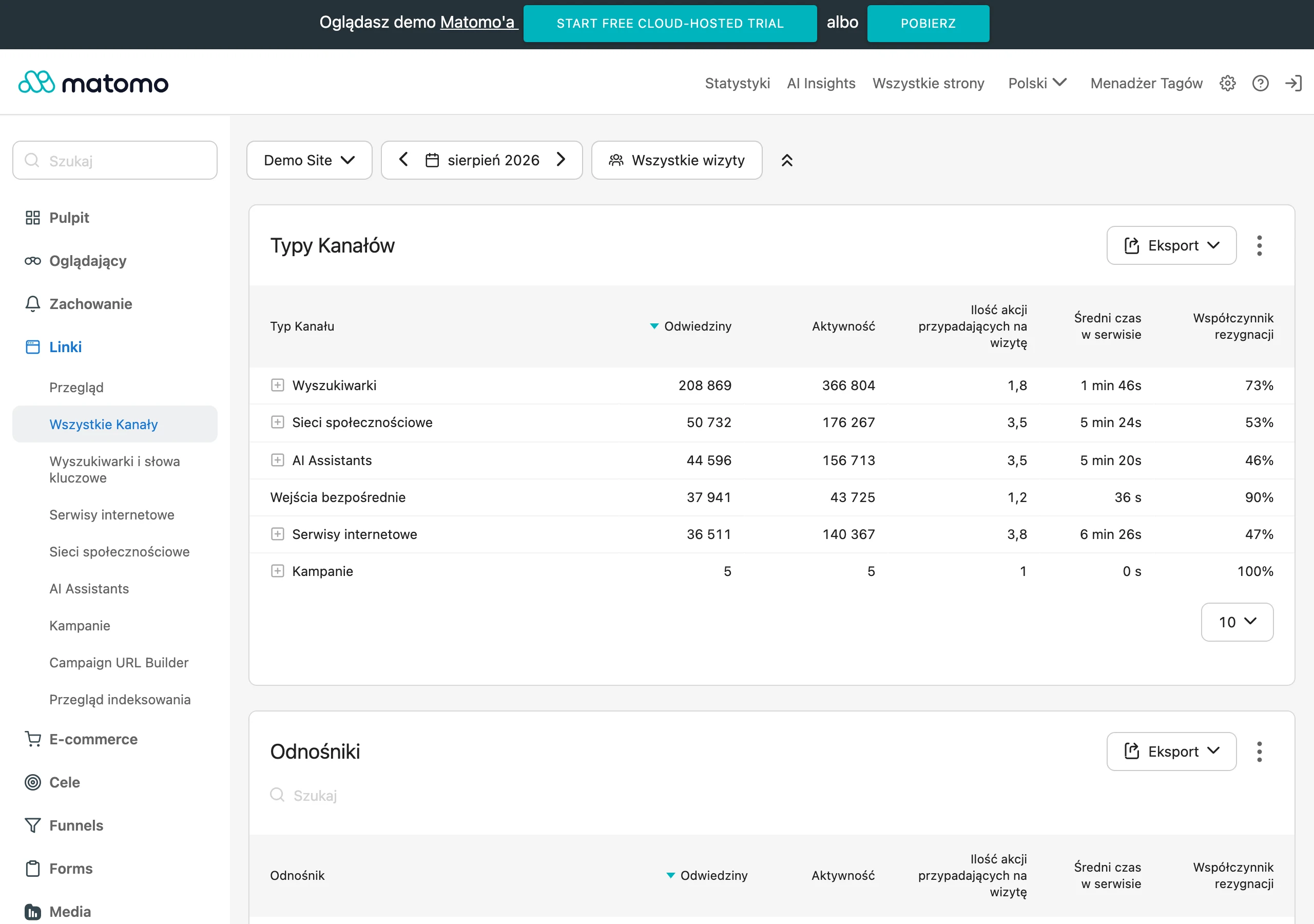
The simplest measurement is based on digital signals that the platform or analytics tools show immediately. These include clicks on the map, starting navigation, phone calls, visits to a local landing page, forms, bookings and click-and-collect orders. These are good indicators where the user has a short path to action and you do not need to infer what happened later offline.
If the priority is to bring customers to a location or increase in-store sales, measurement needs to be based on several sources at once. Redeemed vouchers, codes assigned to locations, code scans, POS data, local sales uplifts and comparisons of footfall between locations or over different periods all help. Single signals rarely give a clear answer, but together they show a much more reliable picture than one metric alone.
In practice, it is better to look at results at the level of a single location rather than only the entire campaign. Two stores in the same city can have different peak hours, a different share of pedestrian traffic and different effectiveness of the same message. For this reason, cost per conversion, number of calls, direction clicks, offer usage and the spend-to-result ratio are analysed separately for each point. The average result for the whole campaign often masks both the weakest and the strongest locations.
Optimisation usually starts with the delivery radius and schedule. If a campaign gets lots of clicks but generates few visits or calls, the cause is often an area that is too broad or contact at the wrong time. If reach is small but quality metrics look good, it is worth cautiously expanding the area or adding similar zones. In parallel, different messages tailored to the context of the place are tested, for example separately for offices, housing estates and shopping centres.
Comparing segments is also important. People who are regularly in the area may react differently from users who appear there only occasionally, and returning customers differently from new ones. If you have first-party data, you can check whether a message about order collection, a local promotion or a reminder to visit again works better. This allows the budget to be shifted to where the likelihood of a real visit is highest.
For larger-scale campaigns, it pays to compare test areas with control areas. The simplest version is to run the campaign only in part of the locations or only during selected hours and check the difference against comparable points without delivery. Such a test does not provide mathematical certainty in every sector, but it helps separate the effect of advertising from seasonality, weather or natural fluctuations in traffic.
In the end, what matters is not the number of metrics, but whether they help you make decisions. If a given indicator does not make it easier to change the radius, bid, message, schedule or list of locations, its value is limited. Good geolocation analytics is not about collecting everything, but about quickly identifying where the campaign is actually delivering real user action.
FAQ
Frequently asked questions
How does geolocation in marketing work in practice?
It involves triggering ads or messages based on the place where the user is, or their visits to a specific zone. It is used, among other things, to promote something near a store, during events or to people who often stay in a given area.
Is location alone enough for a local campaign to work effectively?
No, because a point on the map alone does not guarantee results. Timing, user intent, offer availability and whether the user can take the next step straight after clicking also matter.
When does geolocation work best in advertising?
It works best when the channel matches user intent, for example in search and maps when looking for a place nearby. It also works well in social media for building local reach, and in apps, SMS and push notifications when the brand can react quickly and has the user’s consent.
Which data are most important in geolocation campaigns?
The brand’s own data matter a great deal, especially from apps, CRM, loyalty programmes and sales systems. Location accuracy, user consent and consistent operational data, such as opening hours or product availability, are also important.
Why can too small a delivery radius worsen campaign performance?
Because in dense urban areas, shopping centres or with street traffic, location can be unstable. Then the campaign loses reach faster than it gains relevance, so it is better to test zones based on real walking or driving time.
How do you measure the results of geolocation campaigns if sales are offline?
It is not based on a single metric, but on several signals such as clicks for directions, phone calls, voucher use, code scans or increased sales in a specific location. Offline measurement is usually approximate, so it is worth combining different data instead of trusting one result.