


Google Maps API can genuinely shorten the customer journey from finding a business to making contact, visiting or placing an order. In local business, however, it is not about the map on the website itself, but about tying the location to a specific process. A well-implemented solution makes it easier to find a branch quickly, check directions, enter an address without mistakes or confirm service availability in a given area. A poorly implemented one raises costs, weighs down the site and worsens user experience, especially on mobile. It brings the greatest value when the map becomes a tool that drives conversion, rather than just a visual extra. In practice, the key factors here are the business goal, data quality and proper integration with the rest of the website or app.
What is Google Maps API and how does it work in local business?
Google Maps API is a set of services that allow you to add a map, place search, address suggestions, geocoding and route planning to a website or app. For local business, this means the ability to show a single location, build a multi-location store locator or verify whether a customer is within the serviced area. It is not one module, but several services selected depending on the need. Most often, a map in the interface, address data, branch-matching logic and event analytics are used.
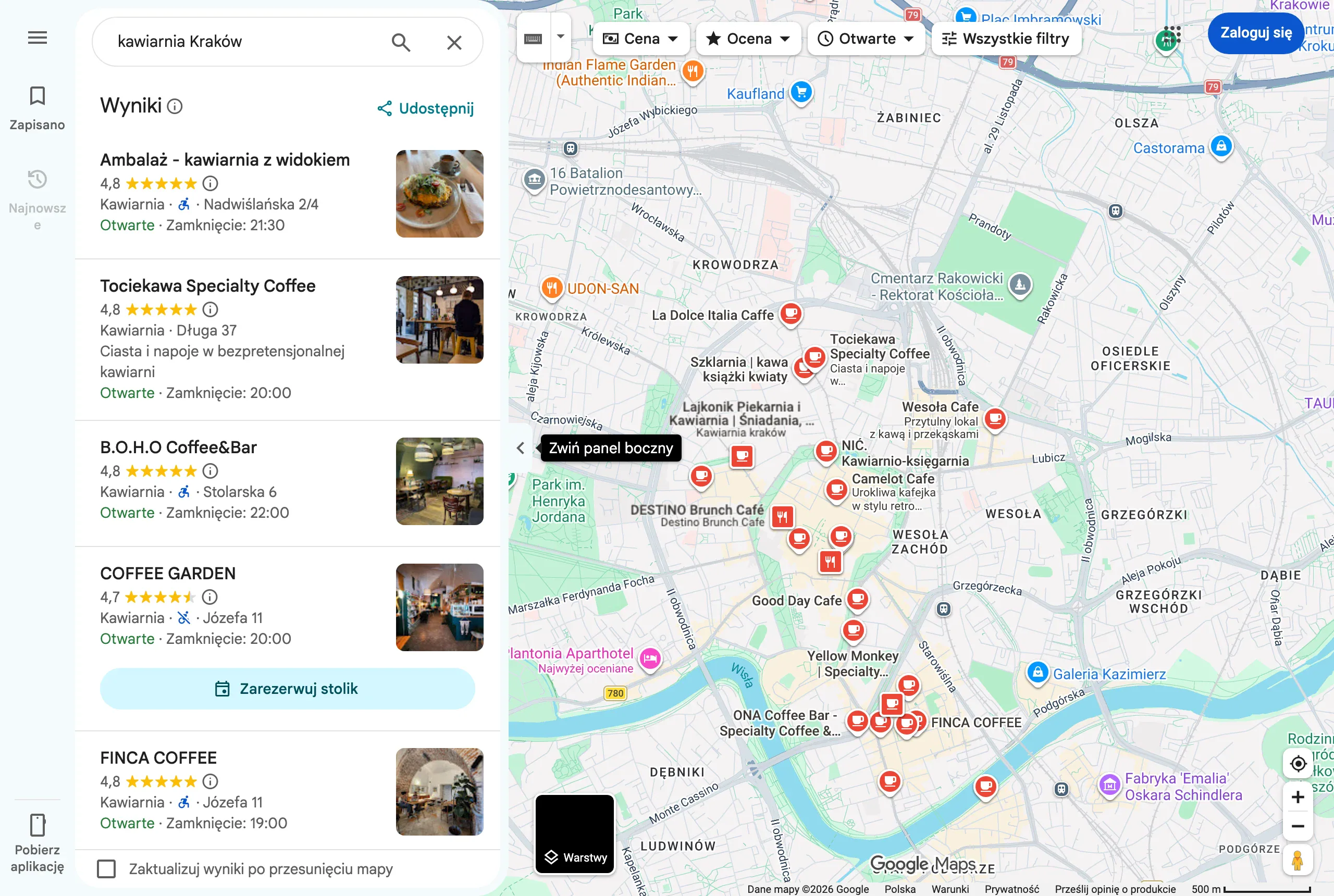
It works best where the user has to make a quick “here and now” decision. This could be choosing the nearest branch, checking journey time, finding a collection point or entering a delivery address without typos. If, after seeing the map, the user does not have a clear path to the next step, the implementation usually does not use its full potential. That is why the map should be linked to navigation, a phone call, a booking, a form or a message about service availability.
From the technical side, it looks simple: the user enters an address or uses geolocation, the system converts that data into coordinates, and then compares it with the branch or delivery-area database. On that basis, it is possible to point to the nearest location, calculate a route, estimate journey time or assign a request to the correct branch. In more advanced implementations, filters, point categories, opening hours and different service types are added.
Another major benefit is form relief. Address suggestions reduce the number of errors, shorten completion time and improve the quality of data entering the CRM, order management or booking system. In local business, a correct customer address often translates directly into service cost, fulfilment time and sales effectiveness. That is why Maps API is often not only a location presentation tool, but also an operational element.
What are the key elements of implementing Google Maps API?
The key elements of implementing Google Maps API include the business goal, the right selection of services, data quality, key protection, cost control and a clear interface. They determine whether the solution will genuinely make life easier for customers and the team, or become a source of unnecessary complexity. At the start, it is worth defining exactly what result the user is meant to achieve: find a location, check directions, confirm service for an address or move on to a booking. The most common mistake is launching a map without one clearly described business scenario.
The architecture of the whole solution depends on the chosen goal. A standard contact page usually needs only a map and location details, whereas a multi-location store locator already means search, filtering, matching logic and integrations with other systems. When a customer enters an address, geocoding, autocomplete and service-area validation are usually also needed. It is best to choose only those services that genuinely support the process, because each additional function increases the number of calls and, along with it, the costs.
From a technical standpoint, the implementation requires a Google Cloud account, activation of the relevant APIs and billing configuration. From day one, usage also needs to be monitored, because charges depend on the number of requests and the type of services used. API keys should be restricted technically, preferably by separating them for the frontend and backend and applying restrictions for domains, IP addresses and allowed services. A key without restrictions is not only a security gap, but also a risk of costs that can spiral out of control.
The second pillar is location data. The branch database should contain standardised addresses, correct coordinates, opening hours, phone numbers, type of point and any service areas. If the information is inconsistent, even a carefully prepared implementation will return incorrect results or make it harder for the customer to contact you. In practice, it is best to have one source of truth for updating this data, rather than making manual corrections in several places.
The interface is also highly important. On mobile, the address field at the top, a clear list of results, a “navigate” button, quick phone calling and a clear CTA often matter more than the map itself. You also need to take into account no geolocation consent, an ambiguous address, no results nearby and a weaker internet connection. User geolocation should always have a simple alternative in the form of manually entering an address or postcode.
Finally, there is the analytics layer and compliance with usage rules. It is worth measuring not only map impressions, but also address entry, branch selection, route clicks, phone calls, bookings and form abandonment. You should also verify the licensing rules of Google Maps Platform and the way address and location data are processed in other systems. These are exactly the issues that distinguish a simple map widget from an implementation that in practice supports sales and service.
Which implementation decisions are most important for a local business?
The most important implementation decisions include the project objective, functional scope, data quality and how costs are controlled. At the outset, it is worth deciding whether the system is meant only to display one location, or whether it should handle multiple locations, delivery zones, selecting the nearest branch or qualifying a customer’s address. That choice determines which APIs will be needed, how many calls there will be and how complex the integration will become. The most expensive mistake is launching an overcomplicated solution without a single, clearly defined business objective.
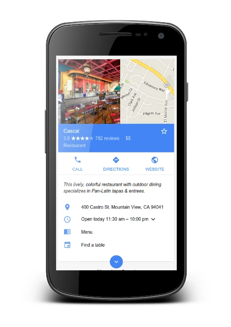
The second key decision concerns the rules by which a customer is matched to a service. In some businesses, the nearest branch calculated by distance is enough. In others, travel time, team availability, service area or a specific type of location, such as a salon, service centre or collection point, matters more. If this logic is not nailed down from the start, the user may receive results that are formally correct but commercially off the mark.
The third decision concerns data. You need structured addresses, accurate coordinates, up-to-date opening hours, phone numbers, location categories and a single system from which this information is updated. A map will not fix poor input data; it will only show it faster and more widely. This is particularly important for multiple locations, where discrepancies between the website, CRM and actual availability quickly undermine user trust.
The technical architecture is no less important. The frontend and backend should not operate on a single API key, because that makes security and usage control more complicated. Keys should be restricted to domains, IP addresses and specific services, and billing kept in check through limits and alerts. In practice, a local business often does not need a full map at every stage of the user journey, so it is worth deciding where the map is essential and where a list of locations or an address validation result is enough.
- One location or multiple locations with filtering and result ranking.
- The nearest location by distance or by travel time and availability.
- Address autocompletion only in the form, or also in the locator and delivery zones.
- The source of truth for location data and how it is updated.
- Key security, cost limits and an error-handling plan.
It is also worth deciding how to handle the user’s geolocation. Browser permission can speed up location selection, but the whole process should not rely on it alone. Some people will refuse location access, some use company devices with restrictions, and some simply prefer to enter a postcode or city. A good implementation always has a fully functional manual address search path.
Finally, it is worth looking at legal and operational requirements. If you store addresses, assign them to zones and pass them to other systems, you need to verify compliance with the Google Maps Platform policies and your own privacy procedures. This is not a minor technical detail, but a decision that affects how data is stored, the scope of the integration and the future maintenance of the solution.
How to optimise Google Maps API integration with the sales process?
Optimising Google Maps API integration is about shortening the path from location to an action that has real business value. The map should lead to a call, booking, form, order or service availability check, rather than cutting off the user journey at the point-browsing stage. When there is no clear next step after selecting a location, the integration performs worse than it could. The best optimisation is removing unnecessary steps between finding a place and conversion.
In practice, it is best to start with one high-value scenario. For a restaurant, that will be quick access to directions, calling or booking. For field services, checking whether the address falls within the serviced area will matter more. For a network of locations, assigning the customer to the nearest branch and showing the correct phone number and opening hours is often key.
The interface should primarily be designed with mobile devices in mind, because that is where the decision to contact or visit is most often made. The search field should be visible straight away, the results list clear, and buttons such as “call”, “directions” and “book” large enough to tap comfortably with one hand. The map itself should not cover key information. In many cases, the better layout is: search, results list, and only then the location details with the map.
The way address forms work also has a strong impact on results. Autocompletion speeds up entry and reduces the number of mistakes, but only if it does not generate too many requests and does not disrupt the user’s flow. It is worth limiting calls by triggering suggestions sensibly, not firing them blindly after every character, and checking whether the selected address is actually suitable for the next step, such as delivery or an engineer visit. An address entered by the user should not only look correct, but also be operationally usable.
Optimisation also applies to performance. The map does not have to load immediately on every subpage if the user has not yet interacted with the locator. Often it is better to show a list of locations or basic contact details first, and load the map component later. This reduces the load on the page, improves performance on slower connections and limits unnecessary API calls.
Without analytics it is hard to determine whether the integration genuinely supports sales. Simply measuring the number of map views tells you very little about user decisions. It is worth tracking the moments when the user is actually getting closer to contact or purchase:
- entering an address or using geolocation,
- selecting a branch or service area,
- clicking the directions, phone or form option,
- moving on to a booking or placing an order,
- breaking off the process at the address search or verification stage.
Based on this information, you can improve specific parts of the journey. If many people enter an address and the system returns no results, the matching logic or the quality of the area data is often to blame. If users select a location but do not move on, you usually need to improve the visibility of the CTA, refine the message or change the order of the information presented. If usage on phones is poor, the source of the problem is often a slowly loading map or the results list playing too small a role compared with the map itself.
It is also worth preparing fallback scenarios. When geolocation fails, the user should immediately see a field for manually entering the city, street or postcode. When an address can be interpreted in several ways, the interface should ask for clarification rather than cutting off the process with a technical error message. A well-optimised integration does not assume perfect conditions, but keeps the user moving forward despite typical problems.
What are the most common mistakes when using Google Maps API?
The most common mistakes are implementing a map without a clearly defined goal, poor data quality, no oversight of costs and a badly designed mobile interface. In practice, many companies add a map just because it “should be there”, but do not connect it with booking, contact, directions or checking service availability. A map that does not lead to the next step rarely delivers real business value. If the user can see the location but has no simple way to call, get directions or choose a branch, the journey ends halfway through.
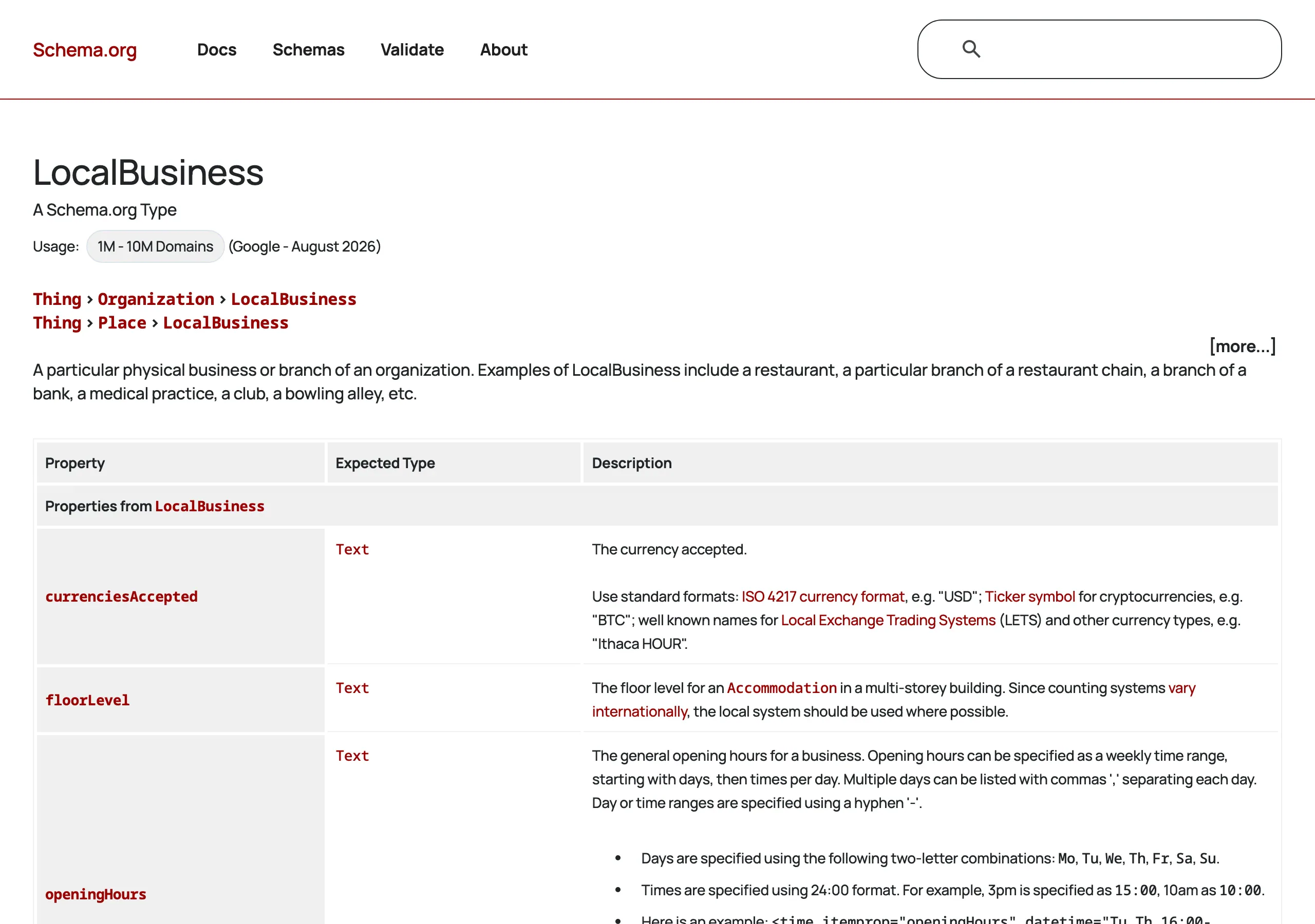
The second common problem is disorganised branch data. Incorrect coordinates, mixed address formats, outdated opening hours or inconsistent branch names lead to wrong search results and incorrect assignment of the customer to a location. Even a well-built integration will not hold up if the input data is unreliable. This is especially important for delivery zones, field service and multi-location locators.
The selection logic itself also often fails. Companies point to the “nearest location” based on straight-line distance, even though in practice travel time, service area, type of branch or availability of a specific service matter more. As a result, the user gets a theoretically correct suggestion, but ends up somewhere that does not satisfy their need. That is a design flaw, not just a technical one.
A separate category consists of cost and security issues. A publicly accessible key without restrictions, no limits, no alerts and overly aggressive address autocomplete requests can needlessly drive up costs. Separate keys for frontend and backend, plus restrictions by domain, IP and services, are a basic standard, not an optional extra. It is also worth limiting the number of calls through sensible delays, loading components on demand and removing unnecessary requests.
A serious mistake is designing the entire experience solely around the map. On a phone, users will often make quicker use of the address field, results list, filters and the “navigate” button than manually panning the map. That is why you should plan for a scenario without geolocation, without browser permission and without convenient interaction with the map. A good implementation also works when the user enters the city, postcode or full address manually.
In practice, analytical mistakes also keep coming back. The team can see the number of map views or clicks on pins, but has no clarity as to whether the user found the right location and whether they moved on to a call, booking or order. Without this, it is hard to distinguish a function that genuinely supports sales from one that merely catches the eye. Such a lack of measurement usually ends in misguided optimisation decisions.
How do you measure the effectiveness of a Google Maps API implementation?
The effectiveness of a Google Maps API implementation is assessed by its impact on specific user actions and business outcomes, not by the mere fact that the map is displayed. First you need to establish which process the map is meant to shorten or simplify: finding a branch, confirming service for an address, starting a route, phone contact or a booking. The best measurement model starts with one main goal and several supporting events. This makes it clear which interactions really lead to conversion.
The most practical approach is to build a simple funnel of events. At the beginning, you measure entry into the location module, then entering an address or using geolocation, then selecting a location or confirming the zone, and finally clicking the CTA. This setup quickly shows where users drop off: during search, due to no results, at the branch selection stage or only just before contact.
- entering an address or postcode,
- agreement or refusal of geolocation,
- the number of returned results and selection of a branch,
- clicking “route”, “call”, “book”, “order”,
- search errors, no address support, no results,
- time to receive a result and abandonment of the module.
Behaviour analytics alone is not enough if you do not combine it with the final outcome. It is worth checking whether people using the store locator are more likely to book an appointment, complete the form, choose click and collect, or contact the branch. If the map increases usage but does not improve the next step, the cause most often lies in the matching logic or in the CTA. This kind of observation can be far more valuable than the mere information about the number of interactions with the map.
Reliable measurement should also take the technical side into account. It is worth monitoring module load time, the number of API errors, geocoding performance, the share of ambiguous addresses and differences between mobile devices and desktop. In local business, mobile plays a major role, so even a functionally correct module can lose effectiveness because of slower loading or elements that are too small to tap.
It is worth segmenting the results by location, type of branch and traffic source. A user from a local campaign may behave differently from someone who arrived via organic results or returned directly to the contact page. Customer needs also diverge between those looking for the nearest point, checking the delivery zone or planning a visit at a specific time. Only segment analysis shows whether the problem affects the whole implementation or just one scenario.
Finally, the data needs to be regularly turned into changes on the product side. If many people enter an address but do not select a point, reorder the results or clarify the filter names. If users click “route” but rarely call, perhaps the phone number is not prominent enough or they are being sent to the wrong branch. Measurement only makes sense when it leads to concrete improvements in the data, interface and operating logic.
FAQ
Frequently asked questions
How does Google Maps API help in local business?
It makes it easier to find a business, check directions, enter an address without mistakes and confirm whether a service is available in a given area. This means the map can lead the user to contact, a visit or an order.
Is Google Maps API enough just to show a map on the website?
No, the article emphasises that a map alone is not enough. It adds the most value when it is linked to the next step, for example a phone call, booking, form or a message about service availability.
What are the most important elements when implementing Google Maps API?
The most important are the business goal, the right choice of services, data quality, key protection, spending control and a clear interface. These determine whether the solution really supports customers and the team.
When is it worth using geolocation, and when manual address entry?
Geolocation speeds up point selection, but it should not be the only option. The article recommends always providing manual entry of the address or postcode, because some users will not consent to location access.
How can you optimise a Google Maps API integration so it supports sales?
You need to shorten the path from finding a location to the action that has business value, for example a phone call, booking or order. It also helps to remove unnecessary steps, use a good mobile layout and analyse where users drop out of the process.
What mistakes most often ruin a Google Maps API implementation?
The most common problems are a lack of a clearly defined goal, poor data quality, no cost control and an underdeveloped mobile interface. Another mistake is showing the “nearest location” without the right logic for matching real business needs.